
Where it happened
Pinpointing the site of the disaster today
Research for Dresden 1957 has involved a lot of detective work, and I've really been enjoying this aspect of the project. It's like finding puzzle pieces and assembling them bit-by-bit as we reconstruct the stories.
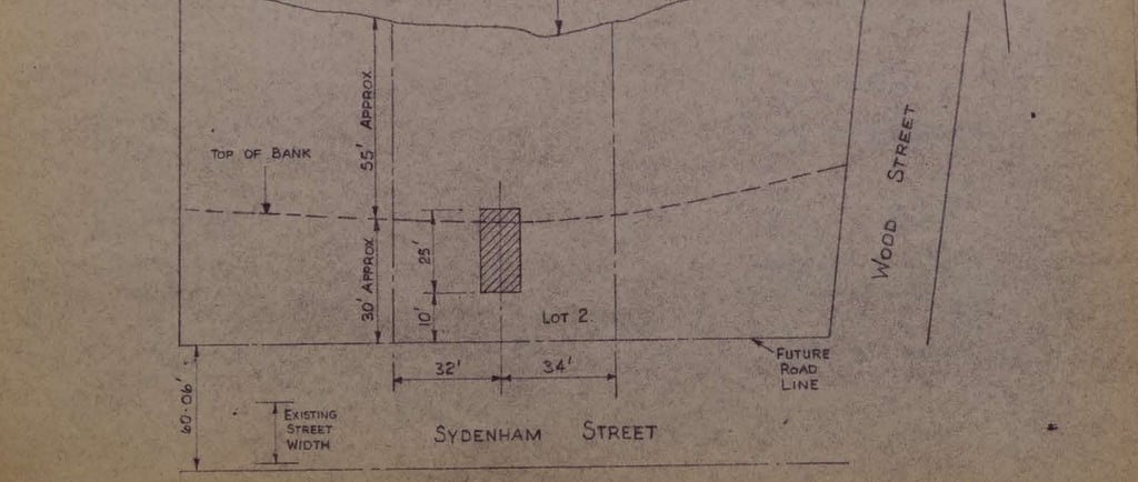
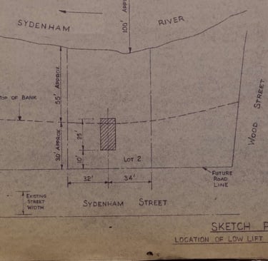
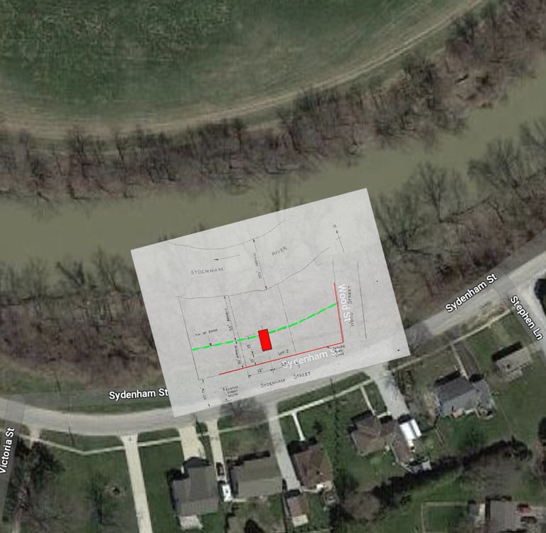
For example, my father had saved all of his own documents from the Dresden project, including a top-down view of the site, showing the planned location of the pumping station. This gave us the area, but I wanted to see if we could pin down the position more precisely. When I checked the satellite view on Google maps I made an interesting discovery.
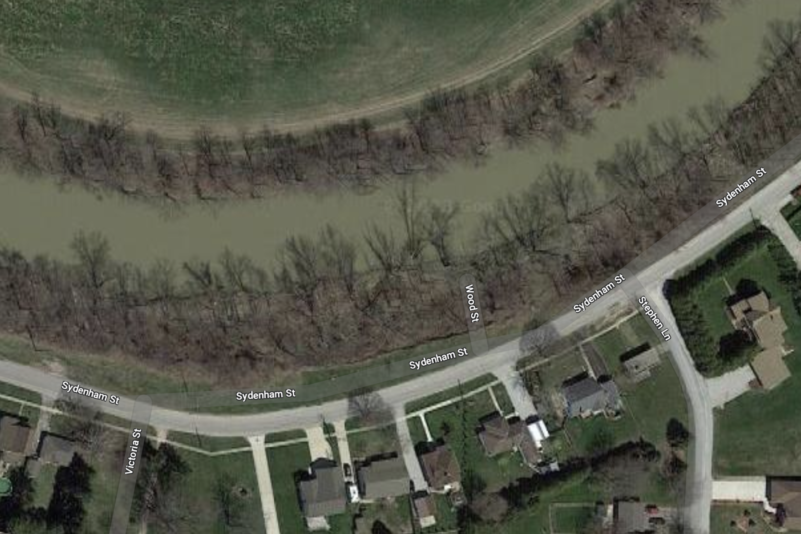
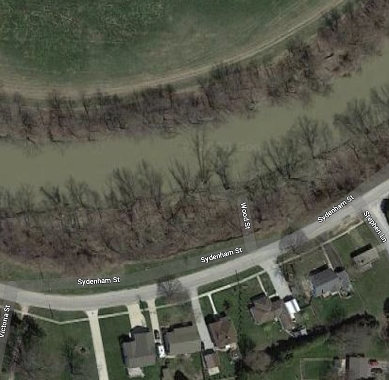
Google maps still shows the ghost of a "Wood Street," as well as a ghost of the once-planned change to Sydenham Street. Neither of these changes were ever made, but Google obviously still has the town's old planning data. My father's drawing show the planned positions of both of these streets, so I could line them up with the Google map.
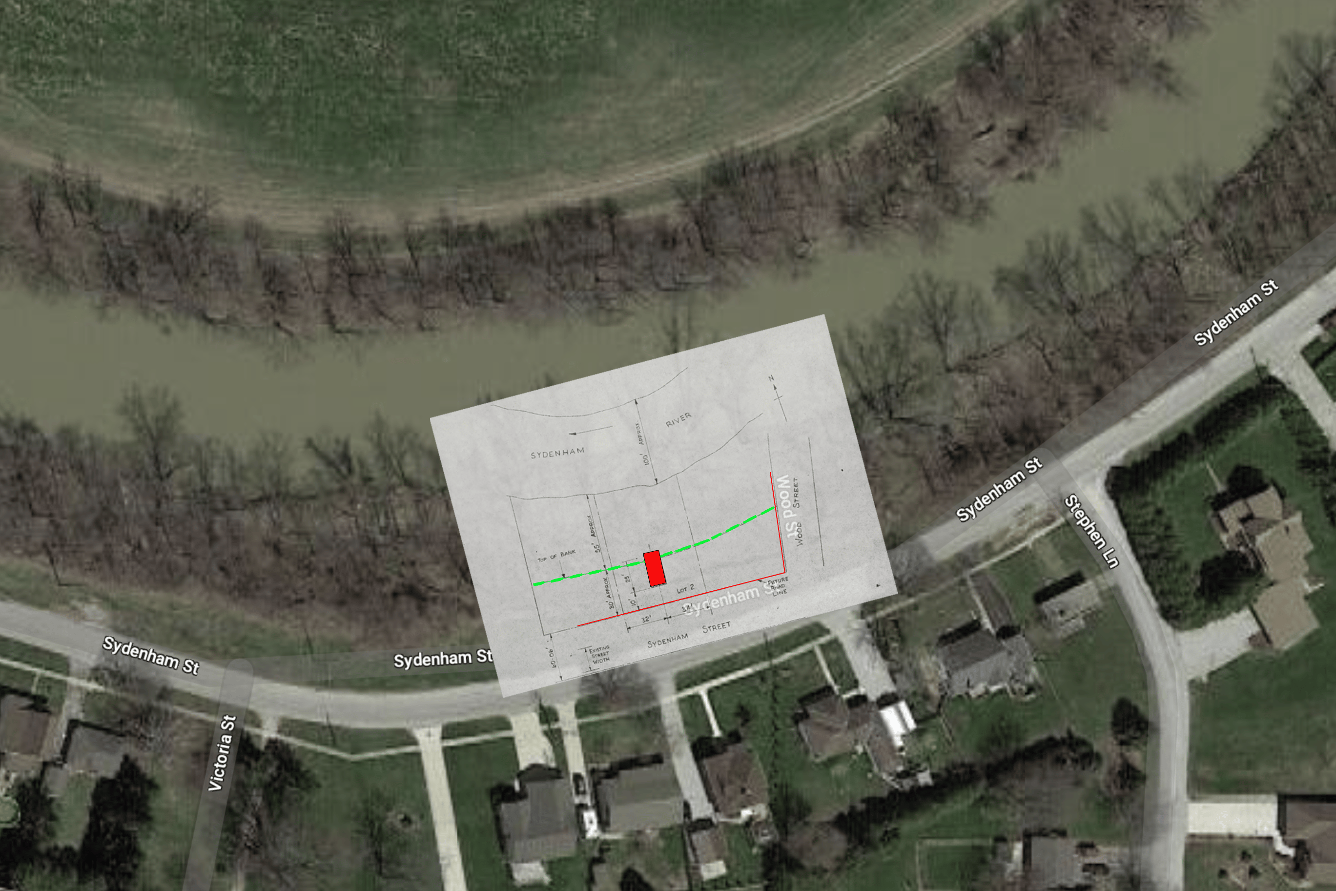
This gave me a pretty good idea of position of the excavation. My next task was to find other ways to confirm it, such as period photos of the site and details reported by eye witnesses. There's a good reason this was tricky. Flooding and erosion have washed away all outward signs of the site, so the process had to be a little more painstaking than I originally hoped.
In the end, the answer was right under our noses. Several photos, including one by my father show the distinctive roofline of a house directly across from the site in 1957. It turns out, that house is still standing today and has the same roofline and gable.
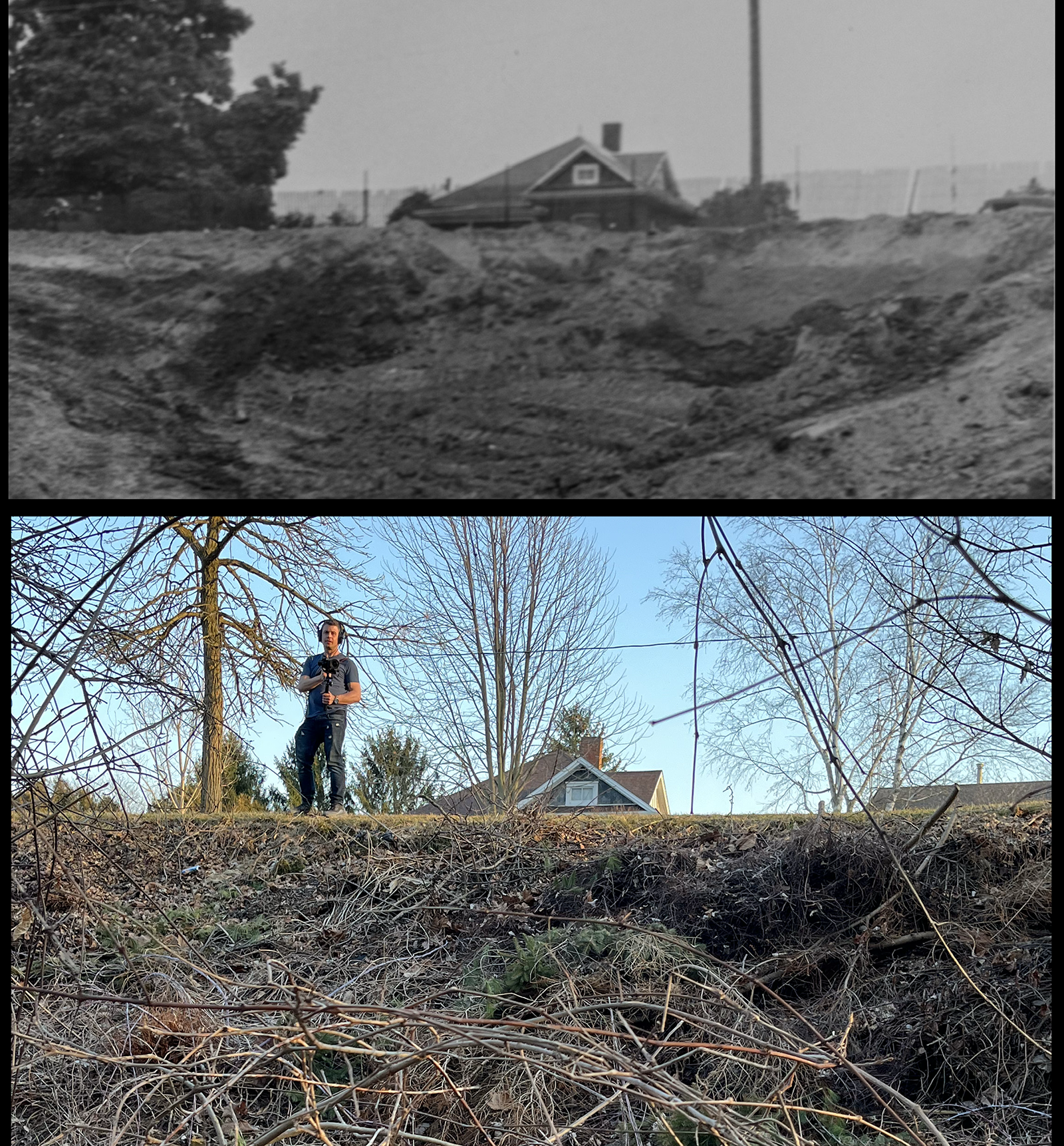
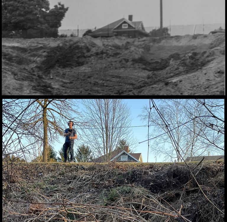
On a recent trip to Dresden, we visited the site. With the leaves off the trees, I wanted to see if I could find the position where my father took a photo, after the pit was filled in (top image above) - and to get that final confirmation.
Well, I got the confirmation I wanted, but it was interesting to discover that my father's vantage point was both higher and further away than any position that I could find today. This is further evidence of the erosion. From my father's drawing, it looks like the top of the bank has receded as much as 20 feet. And the same flooding and water flow that eroded the top of the bank must have also washed away most, or all, of the soil that had been piled up from the excavation.
Today there are no obvious signs of the tragedy that happened 67 years ago. The concrete foundation, the last act of those six men, is still there, but it's buried approximately 30 feet below the area shown in the image above Perhaps one day it will be uncovered as a kind of monument to the lives that were lost in this place.
Copyright Eric Philpott, 2025